- Nowości
 - 


										Mapy i publikacje
									
														
					add remove 					Mapy papierowe add removePublikacje papierowe add remove
 - 


										Nawigacja
									
														
					add remove 					Zegary add removeBarometry add removeTermometry , Higrometry, Barografy add removeAreometry (Densymetry) add remove
 - 


										Sygnalizacja
									
														
					add remove 					Lampy Nawigacyjne, Szperacze add removeŻarówki add removeLatarki add removeZnaki dzienne add remove
 - 


										Środki ratunkowe
									
														
					add remove 					Kamizelki add removeTratwy add removeKombinezony ratunkowe add removePirotechnika morska add removeKoła, Pławki, Tyczki add removeUprzęże, Linki, Taśmy Bezpieczeństwa add removeReflektory radarowe add removeBosaki, Wiosła add remove
 - 


										Elektronika morska
									
														
					add remove 					Radiotelefony add removeOdbiorniki Pogody add removePLB / AIS MOB, OLAS add removeRadiopławy, Transpondery add removeWiatromierze add removeAkcesoria add remove
 - 


										Sprzęt pożarowy
									
														
					add remove 					Akcesoria add remove
 - 


										Wyposażenie pokładowe
									
														
					add remove 					Drabinki Pilotowe, Ewakuacyjne add remove
 
- Nowości
 - 
					
						
												Mapy i publikacje


						add remove 						Mapy papierowe add removePublikacje papierowe add remove
 - Nawigacja add remove
 - Sygnalizacja add remove
 - Środki ratunkowe add remove
 - Elektronika morska add remove
 - Sprzęt pożarowy add remove
 - 
					
						
												Wyposażenie pokładowe


						add remove 						
 
NV Atlas England - UK 2 - Start Point to The Needles
Description
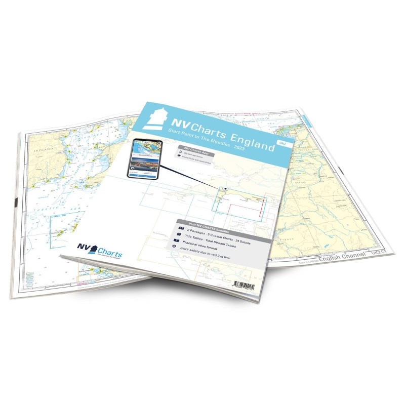
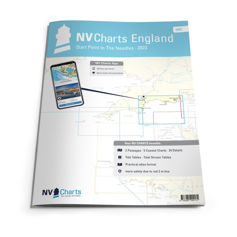
The UK2 takes you along the picturesque rocky coast between the counties of Dorset and Devon. Landmark destinations such as The Needles, a group of three chalk islands on the western tip of the Isle of Wight, and Portland Bill, which shows you the safe route to Weymouth, are included in this chart set. Past the "English Rivera" with the mildest climate that England has to offer, it goes up to Start Point.
The coastline on this chart series, also known as the "Jurassic Coast", was one of the first natural landscapes in England to be included in the UNESCO World Heritage List. In addition to the impressive rock and coastal formations, this region is also known as a fossil site. So if you long for a relaxing trip close to nature, you are well equipped with the UK2!
Our charts are based on official data from the United Kingdom Hydrographic Office (UKHO) and contain additional harbour plans and details for approaches and passages in the waters. Thanks to the clear structure, the skipper can quickly find tide data, approaches, harbours and anchorages and is informed of important navigational details that also appear in the NV Charts app. The chart series impresses with its optimal scales and balanced sheet cuts.
This chart set includes
2 Passage Charts5 Coastal Charts
24 Details Charts
Code for the app
Digital charts & navigation program
Navigation instructions in English
Tide tables
Paper charts & Digital
Meets legal requirements for up-to-date paper charts on board


                                                        Cookies