- Nowości
 - 


										Mapy i publikacje
									
														
					add remove 					Mapy papierowe add removePublikacje papierowe add remove
 - 


										Nawigacja
									
														
					add remove 					Zegary add removeBarometry add removeTermometry , Higrometry, Barografy add removeAreometry (Densymetry) add remove
 - 


										Sygnalizacja
									
														
					add remove 					Lampy Nawigacyjne, Szperacze add removeŻarówki add removeLatarki add removeZnaki dzienne add remove
 - 


										Środki ratunkowe
									
														
					add remove 					Kamizelki add removeTratwy add removeKombinezony ratunkowe add removePirotechnika morska add removeKoła, Pławki, Tyczki add removeUprzęże, Linki, Taśmy Bezpieczeństwa add removeReflektory radarowe add removeBosaki, Wiosła add remove
 - 


										Elektronika morska
									
														
					add remove 					Radiotelefony add removeOdbiorniki Pogody add removePLB / AIS MOB, OLAS add removeRadiopławy, Transpondery add removeWiatromierze add removeAkcesoria add remove
 - 


										Sprzęt pożarowy
									
														
					add remove 					Akcesoria add remove
 - 


										Wyposażenie pokładowe
									
														
					add remove 					Drabinki Pilotowe, Ewakuacyjne add remove
 
- Nowości
 - 
					
						
												Mapy i publikacje


						add remove 						Mapy papierowe add removePublikacje papierowe add remove
 - Nawigacja add remove
 - Sygnalizacja add remove
 - Środki ratunkowe add remove
 - Elektronika morska add remove
 - Sprzęt pożarowy add remove
 - 
					
						
												Wyposażenie pokładowe


						add remove 						
 
NV. Italy IT 4, Sardinia West- atlas map
Description
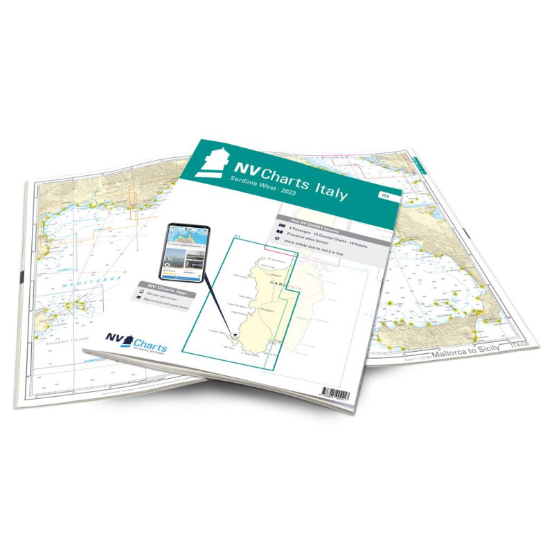
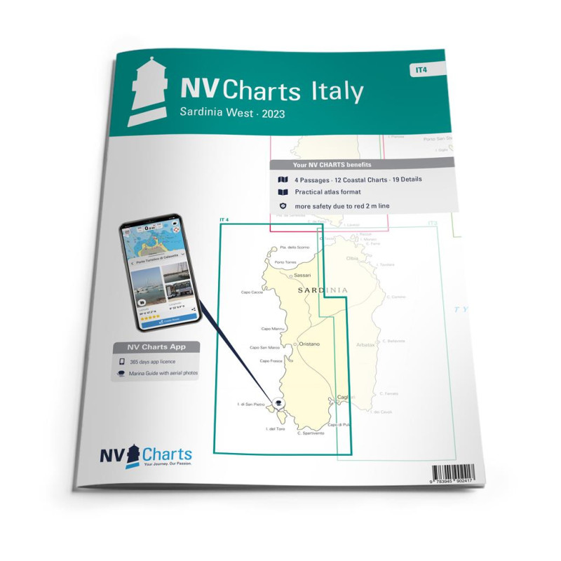
The Sardinian west coast should not be visited without the IT4. The set of charts starts below the town of Costa Paradiso, which bears the same name as the coast. The Gulf of Asinara begins with the wonderful harbour of Porto di Castelsardo. It is only a few nautical miles to the magical Stintino on a westerly course. If you want to circumnavigate the former penal colony Isola Asinara, you can simply shorten it with the passagio dei Fornelli. You should also set a course for the beautiful Sinis peninsula. There are hardly any harbours or bays along the way, especially since the waves and the underwater cliffs make approaching difficult. At Cap San Marco in the Golfo di Orsitano you can find shelter from the west wind. The next destinations are the two charming offshore islands Isola di San Pietro and Isola di Sant'Antioco. Even in the off-season, a trip is very possible due to the pleasant climate of Sardinia.
Thanks to the clear structure the skipper can quickly find approaches, harbours and anchorages and is informed of important navigational details that also appear in the NV Charts app. The chart series impresses with its optimal scales and balanced sheet cuts.
This chart set contains
4 Passage Charts12 Coastal Charts
19Details Charts
Code for the app
Digital charts & navigation programme
Paper harbour plans & Digital
Navigation instructions in English and Italian
Meets legal requirements for up-to-date paper charts on board


                                                        Cookies