Zamknij arrow_back
- Nowości
-
Mapy i publikacje
add remove Mapy papierowe add removePublikacje papierowe add remove
-
Nawigacja
add remove Zegary add removeBarometry add removeTermometry , Higrometry, Barografy add removeAreometry (Densymetry) add remove
-
Sygnalizacja
add remove Lampy Nawigacyjne, Szperacze add removeŻarówki add removeLatarki add removeZnaki dzienne add remove
-
Środki ratunkowe
add remove Kamizelki add removeTratwy add removeKombinezony ratunkowe add removePirotechnika morska add removeKoła, Pławki, Tyczki add removeUprzęże, Linki, Taśmy Bezpieczeństwa add removeReflektory radarowe add removeBosaki, Wiosła add remove
-
Elektronika morska
add remove Radiotelefony add removeOdbiorniki Pogody add removePLB / AIS MOB, OLAS add removeRadiopławy, Transpondery add removeWiatromierze add removeAkcesoria add remove
-
Sprzęt pożarowy
add remove Akcesoria add remove
-
Wyposażenie pokładowe
add remove Drabinki Pilotowe, Ewakuacyjne add remove
- Nowości
-
Mapy i publikacje
add remove Mapy papierowe add removePublikacje papierowe add remove
- Nawigacja add remove
- Sygnalizacja add remove
- Środki ratunkowe add remove
- Elektronika morska add remove
- Sprzęt pożarowy add remove
-
Wyposażenie pokładowe
add remove
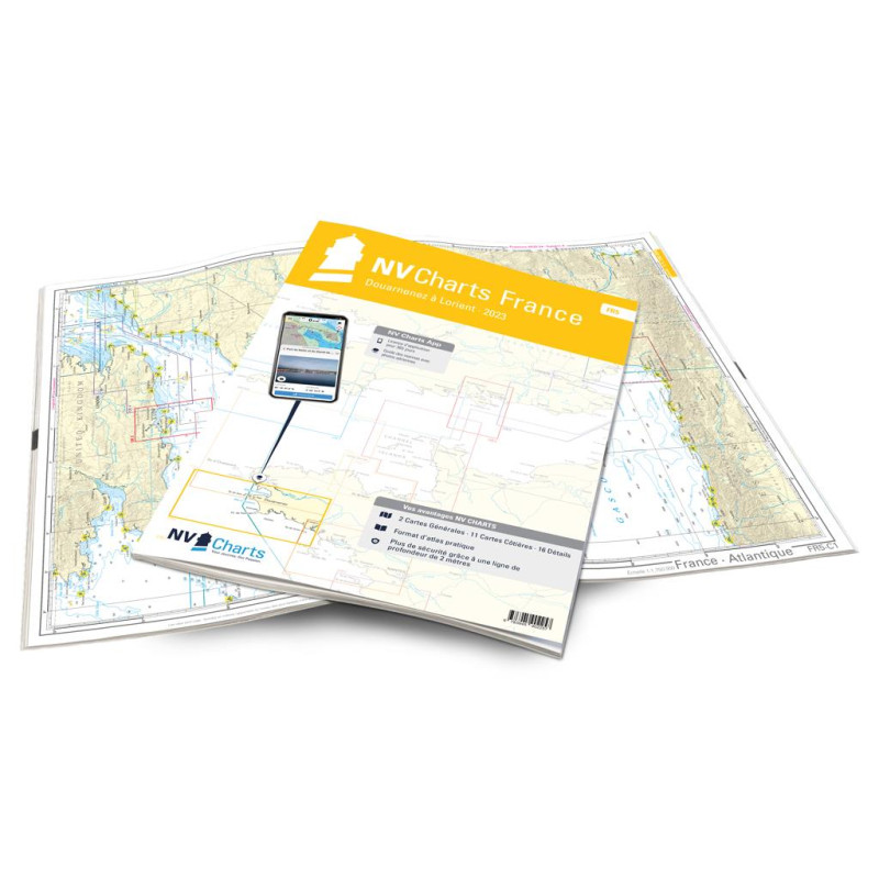
NV Atlas France - FR 5 - Douarnenez à Lorient
Edycja: 2023
Description
The FR5 starts in the history-rich town of Douarnenez with its large fishing port. Here you also have the notorious Bay of Biscay in front of your eyes.
The nautical chart takes you along the Île de Sein which is about 8km from the coast. The Bay of Audierne stretches from the Pointe du Raz to the Pointe de Penmarch. This whole bay proves to be a truly exceptionally beautiful and natural area with 10km of dune area. Concarneau a medieval port town is also worth a visit. Alternatively the Glénan Islands 10 nautical miles from Concarneau are a good option. Between rocks the route leads into the archipelago to the buoy field.
The clearly laid out layout enables the sports skipper to find approaches harbours and anchorages quickly and is pointed out to navigationally important details that also appear in the nv charts app. The chart series impresses with its optimal scales and balanced sheet sections in the 30 x 42cm format.
This chart set includes
2 Passage Charts11 Coastal Charts
16 Details Charts
Code for the app
Digital charts & navigation programme
Navigation notes in English and French
Tide tables
Paper harbour plans & Digital
Meets legal requirements for up-to-date paper charts on board
Podobne z kategorii
Availability: Out of stock
Edycja: 2023

















 Cookies