- Nowości
-
Mapy i publikacje
add remove Mapy papierowe add removePublikacje papierowe add remove
-
Nawigacja
add remove Zegary add removeBarometry add removeTermometry , Higrometry, Barografy add removeAreometry (Densymetry) add remove
-
Sygnalizacja
add remove Lampy Nawigacyjne, Szperacze add removeŻarówki add removeLatarki add removeZnaki dzienne add remove
-
Środki ratunkowe
add remove Kamizelki add removeTratwy add removeKombinezony ratunkowe add removePirotechnika morska add removeKoła, Pławki, Tyczki add removeUprzęże, Linki, Taśmy Bezpieczeństwa add removeReflektory radarowe add removeBosaki, Wiosła add remove
-
Elektronika morska
add remove Radiotelefony add removeOdbiorniki Pogody add removePLB / AIS MOB, OLAS add removeRadiopławy, Transpondery add removeWiatromierze add removeAkcesoria add remove
-
Sprzęt pożarowy
add remove Akcesoria add remove
-
Wyposażenie pokładowe
add remove Drabinki Pilotowe, Ewakuacyjne add remove
- Nowości
-
Mapy i publikacje
add remove Mapy papierowe add removePublikacje papierowe add remove
- Nawigacja add remove
- Sygnalizacja add remove
- Środki ratunkowe add remove
- Elektronika morska add remove
- Sprzęt pożarowy add remove
-
Wyposażenie pokładowe
add remove
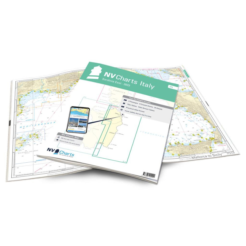
NV. Italy IT 3, Sardinia East - atlas map
Description
Sardinia is calling! The IT3 map set introduces you to the east coast of Sardinia with the Costa Smeralda the Golfo di Orosei and the Costa del Sud with helpful tips. Caution is advised when passing through the Strait of Bonifacio as the wind and waves between Corsica and Sardinia are brisk. Plus 3 i.e. three wind forces more than outside the strait is a common rule there. The north-east is characterised by the rocky island world of the Maddalena archipelago. Around Olbia is the centre of Sardinian yacht tourism. Everywhere you look there are wonderful anchorages to linger in and there is no shortage of harbours either.
The further south you travel along the east coast the quieter it gets. The Gulf of Orosei is an Eldorada for nature lovers with wild and romantic rocky beaches shaped by the foothills of the Supramonte mountain range. The Costa del Sud shines with endless white sandy beaches and dunes up to 30m high. The Caribbean of Europe welcomes you! Wind by the way always blows in Sardinia but more moderately in the east. Instead there are plenty of shoals and rocks that demand a high level of attention.
Thanks to the clear layout the recreational skipper can quickly find approaches harbours and anchorages and is alerted to navigationally important details that also appear in the nv charts app. The chart series impresses with its optimal scales and balanced page cuts.
This chart set contains
4 Passage Charts9 Coastal Charts
24Details Charts
Code for the app
Digital charts & navigation programme
Paper harbour plans & Digital
Navigation instructions in English and Italian
Meets legal requirements for up-to-date paper charts on board







 Cookies