Zamknij arrow_back
- Nowości
-
Mapy i publikacje
add remove Mapy papierowe add removePublikacje papierowe add remove
-
Nawigacja
add remove Zegary add removeBarometry add removeTermometry , Higrometry, Barografy add removeAreometry (Densymetry) add remove
-
Sygnalizacja
add remove Lampy Nawigacyjne, Szperacze add removeŻarówki add removeLatarki add removeZnaki dzienne add remove
-
Środki ratunkowe
add remove Kamizelki add removeTratwy add removeKombinezony ratunkowe add removePirotechnika morska add removeKoła, Pławki, Tyczki add removeUprzęże, Linki, Taśmy Bezpieczeństwa add removeReflektory radarowe add removeBosaki, Wiosła add remove
-
Elektronika morska
add remove Radiotelefony add removeOdbiorniki Pogody add removePLB / AIS MOB, OLAS add removeRadiopławy, Transpondery add removeWiatromierze add removeAkcesoria add remove
-
Sprzęt pożarowy
add remove Akcesoria add remove
-
Wyposażenie pokładowe
add remove Drabinki Pilotowe, Ewakuacyjne add remove
- Nowości
-
Mapy i publikacje
add remove Mapy papierowe add removePublikacje papierowe add remove
- Nawigacja add remove
- Sygnalizacja add remove
- Środki ratunkowe add remove
- Elektronika morska add remove
- Sprzęt pożarowy add remove
-
Wyposażenie pokładowe
add remove
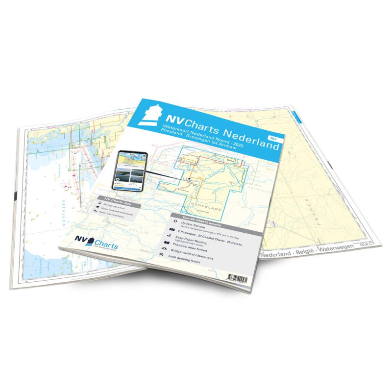
NV Atlas Binnen NL 6 - Waterkaart Nederland Noord - Friesland - Arnhem
Edycja: 2023
Description
For the northern part of the Dutch inland waters, the NL6 is a practical and handy travel companion. Together with the NL7 (Waterkaart Nederland Zuid) the entire inland area of the country can be explored. Cities such as Groningen in the north and Arnhem in the south of the map are also covered in this atlas. The canals, typical for the Netherlands, are almost all navigable and interconnected. The small lakes, canals and little towns offer a charming atmosphere.In contrast to the areas on the North Sea, strong winds, currents and tides are not typical in the inland waterways, which is why you can take it a little easier there overall. The perfect area for beginners or sailors who want to gain a little extra experience. If you long for harmony and don't want to pay attention on currents and tides too much, you will have a lot of fun in the inland waters and with the NL6!
Thanks to the clear structure of the nautical chart, the skipper can quickly find approaches, harbours and anchorages and is informed of important navigational details that also appear in the NV Charts app. The tide data and current information are also available in the app. The chart series impresses with its detailed scales and optimal sheet cuts.
This chart set contains
2 Passage Charts23 Coastal Charts
17 detailed charts
Code for app
Digital charts & navigation programme
Direct transitions to coastal regions
Port plans paper & Digital
Meets legal requirements for up-to-date paper charts on board
Podobne z kategorii
Availability: Out of stock
Edycja: 2023














 Cookies