- Nowości
-
Mapy i publikacje
add remove Mapy papierowe add removePublikacje papierowe add remove
-
Nawigacja
add remove Zegary add removeBarometry add removeTermometry , Higrometry, Barografy add removeAreometry (Densymetry) add remove
-
Sygnalizacja
add remove Lampy Nawigacyjne, Szperacze add removeŻarówki add removeLatarki add removeZnaki dzienne add remove
-
Środki ratunkowe
add remove Kamizelki add removeTratwy add removeKombinezony ratunkowe add removePirotechnika morska add removeKoła, Pławki, Tyczki add removeUprzęże, Linki, Taśmy Bezpieczeństwa add removeReflektory radarowe add removeBosaki, Wiosła add remove
-
Elektronika morska
add remove Radiotelefony add removeOdbiorniki Pogody add removePLB / AIS MOB, OLAS add removeRadiopławy, Transpondery add removeWiatromierze add removeAkcesoria add remove
-
Sprzęt pożarowy
add remove Akcesoria add remove
-
Wyposażenie pokładowe
add remove Drabinki Pilotowe, Ewakuacyjne add remove
- Nowości
-
Mapy i publikacje
add remove Mapy papierowe add removePublikacje papierowe add remove
- Nawigacja add remove
- Sygnalizacja add remove
- Środki ratunkowe add remove
- Elektronika morska add remove
- Sprzęt pożarowy add remove
-
Wyposażenie pokładowe
add remove
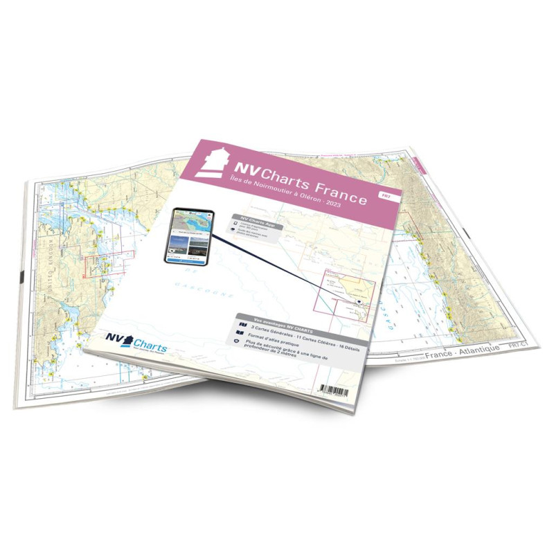
NV Atlas France - FR 7 - Îles de Noirmoutier á Oléron - La Rochelle
Description
The FR7 is the chart series that includes, among other things, the sailing stronghold of La Rochelle. However, the charts begin in Pays de la Loire and there with the charming Atlantic island of Ile de Noirmoutier, which lies south of the mouth of the Loire River. Three well-equipped ports await you here. From there, you can use the nautical chart to go on to Les Sables-d'Olonne. France's second largest seaside resort shines with its maritime flair, especially since the spectacular one-handed regatta "Vendée Globe" starts there every four years. The next stop is La Rochelle, a practical starting point to get to know the three offshore islands Ile de Ré, Ile d'Oléron and Ile d'Aix. Some of the islands offer several small harbours that are the destination of many local sailors in summer. White beaches, excellent restaurants, bars and markets can also be found there.
Thanks to the clear structure, the skipper can quickly find approaches, harbours and anchorages and is informed of important navigational details that also appear in the NV Charts app. The chart series impresses with its optimal scales and balanced sheet cuts.
This chart set contains
3 Passage Charts11 Coastal Charts
16 Details Charts
Code for the app
Digital charts & navigation programme
Navigation notes in English and French
Tide tables
Paper harbour plans & Digital
Meets legal requirements for up-to-date paper charts on board








 Cookies