Zamknij arrow_back
- Nowości
-
Mapy i publikacje
add remove Mapy papierowe add removePublikacje papierowe add remove
-
Nawigacja
add remove Zegary add removeBarometry add removeTermometry , Higrometry, Barografy add removeAreometry (Densymetry) add remove
-
Sygnalizacja
add remove Lampy Nawigacyjne, Szperacze add removeŻarówki add removeLatarki add removeZnaki dzienne add remove
-
Środki ratunkowe
add remove Kamizelki add removeTratwy add removeKombinezony ratunkowe add removePirotechnika morska add removeKoła, Pławki, Tyczki add removeUprzęże, Linki, Taśmy Bezpieczeństwa add removeReflektory radarowe add removeBosaki, Wiosła add remove
-
Elektronika morska
add remove Radiotelefony add removeOdbiorniki Pogody add removePLB / AIS MOB, OLAS add removeRadiopławy, Transpondery add removeWiatromierze add removeAkcesoria add remove
-
Sprzęt pożarowy
add remove Akcesoria add remove
-
Wyposażenie pokładowe
add remove Drabinki Pilotowe, Ewakuacyjne add remove
- Nowości
-
Mapy i publikacje
add remove Mapy papierowe add removePublikacje papierowe add remove
- Nawigacja add remove
- Sygnalizacja add remove
- Środki ratunkowe add remove
- Elektronika morska add remove
- Sprzęt pożarowy add remove
-
Wyposażenie pokładowe
add remove
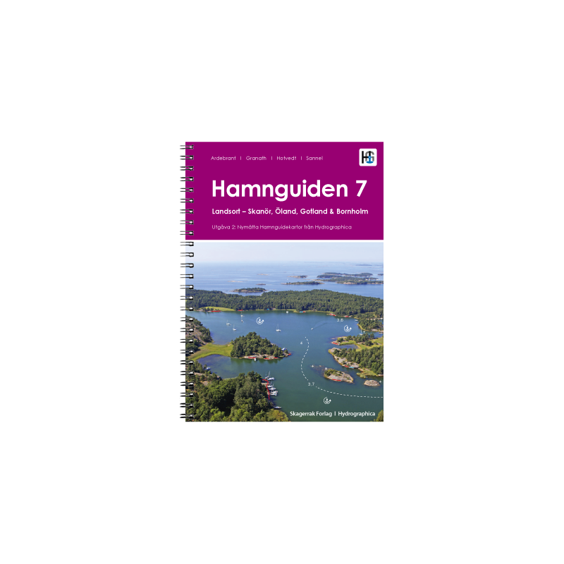
Hamnguiden 7, Landsort - Skanör, Öland, Gotland, j. szewdzki
Description
If you are drawn to the south and south-east of Sweden you should make the journey in the company of this cruising guide. Southern Sweden has a mild sunny climate Bornholm is not far away after all. The coast is sheltered by the two large islands of Öland and Gotland and the archipelago landscape is just as picturesque as that in Stockholm. The book even accompanies you to the Göta Canal. A wonderful addition to all the previous information. Compiled by staff of the Hydrographic Institute as well as journalists who share a passion for introducing you to Swedens wonderful archipelago.
376 gorgeous harbour anchorages and natural harbours are presented by means of large-scale map sketches and well-resolved annotated aerial photographs.
In addition to nautical information such as approach (with waypoints) anchoring and supply possibilities the texts each contain a general section with information on the respective location. Where available the website and telephone number are also given. The use of maps aerial photographs and pictograms throughout make the book very easy to use - even without knowledge of the Swedish language.
428 harbours and anchorages in Swedish (Bornholm in Danish)
414 pages spiral binding
format A4 2018
Podobne z kategorii
Availability: Out of stock
Edycja: 2016
Availability: Out of stock
Edycja: 2023
Availability: Out of stock
Edycja 2022








 Cookies