Zamknij arrow_back
- Nowości
-
Mapy i publikacje
add remove Mapy papierowe add removePublikacje papierowe add remove
-
Nawigacja
add remove Zegary add removeBarometry add removeTermometry , Higrometry, Barografy add removeAreometry (Densymetry) add remove
-
Sygnalizacja
add remove Lampy Nawigacyjne, Szperacze add removeŻarówki add removeLatarki add removeZnaki dzienne add remove
-
Środki ratunkowe
add remove Kamizelki add removeTratwy add removeKombinezony ratunkowe add removePirotechnika morska add removeKoła, Pławki, Tyczki add removeUprzęże, Linki, Taśmy Bezpieczeństwa add removeReflektory radarowe add removeBosaki, Wiosła add remove
-
Elektronika morska
add remove Radiotelefony add removeOdbiorniki Pogody add removePLB / AIS MOB, OLAS add removeRadiopławy, Transpondery add removeWiatromierze add removeAkcesoria add remove
-
Sprzęt pożarowy
add remove Akcesoria add remove
-
Wyposażenie pokładowe
add remove Drabinki Pilotowe, Ewakuacyjne add remove
- Nowości
-
Mapy i publikacje
add remove Mapy papierowe add removePublikacje papierowe add remove
- Nawigacja add remove
- Sygnalizacja add remove
- Środki ratunkowe add remove
- Elektronika morska add remove
- Sprzęt pożarowy add remove
-
Wyposażenie pokładowe
add remove
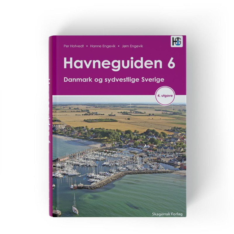
Havneguiden 6 Danmark og sydvestlige Sverige
Description
"Harbour Guide 6" Denmark and Southwest Sweden
This harbour guide covers all of Denmark except Bornholm.
In addition the Swedish west coast from Skanör in the south to Gothenburg in the north is included.
Bornholms and Swedens south and east coasts are covered by Hamnguiden 7 (Swedish text)
In this 3rd edition of the Harbour Guide Denmark and Southwest Sweden all information on each port is updated. In addition the author has decided to include his own anchor symbols on maps and pictures. The symbols indicate which berth you can assign when you arrive in port so that you are best prepared.
In the text you will also find information on the maximum size of ships allowed to enter the port.
We have mentioned both ports and anchorageseach port is presented on a full page of the book.
Help pictures and map drawings and texts give you good and useful information.
The text of each port is divided into a general and a maritime section.
The general section contains information about the place you are visiting with a brief historical background
Further it tells you where and how to moor when to enter and any special conditions around the port.
The address of the sites and the phone number of the port can be found in the info box at the bottom of the page and are updated in this edition. Here you will also find a brief overview of what the port has to offer.
Podobne z kategorii
Availability: Out of stock
Edycja: 2022/2023













 Cookies