- Nowości
-
Mapy i publikacje
add remove Mapy papierowe add removePublikacje papierowe add remove
-
Nawigacja
add remove Zegary add removeBarometry add removeTermometry , Higrometry, Barografy add removeAreometry (Densymetry) add remove
-
Sygnalizacja
add remove Lampy Nawigacyjne, Szperacze add removeŻarówki add removeLatarki add removeZnaki dzienne add remove
-
Środki ratunkowe
add remove Kamizelki add removeTratwy add removeKombinezony ratunkowe add removePirotechnika morska add removeKoła, Pławki, Tyczki add removeUprzęże, Linki, Taśmy Bezpieczeństwa add removeReflektory radarowe add removeBosaki, Wiosła add remove
-
Elektronika morska
add remove Radiotelefony add removeOdbiorniki Pogody add removePLB / AIS MOB, OLAS add removeRadiopławy, Transpondery add removeWiatromierze add removeAkcesoria add remove
-
Sprzęt pożarowy
add remove Akcesoria add remove
-
Wyposażenie pokładowe
add remove Drabinki Pilotowe, Ewakuacyjne add remove
- Nowości
-
Mapy i publikacje
add remove Mapy papierowe add removePublikacje papierowe add remove
- Nawigacja add remove
- Sygnalizacja add remove
- Środki ratunkowe add remove
- Elektronika morska add remove
- Sprzęt pożarowy add remove
-
Wyposażenie pokładowe
add remove
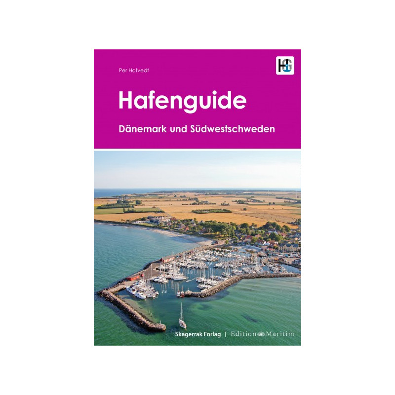
Hafenguide 6 Dänemark und Südwestschweden
Description
The charming Baltic Sea coasts of Denmark with the deep bays including the Limfjord and the widely branching archipelago are among the most popular spots for German sailors and motorboat drivers. The somewhat rougher archipelago off the south-west coast of Sweden also attracts many water sports enthusiasts. This cruising guide leaves no port unmentioned. Whether idyllic anchorage or modern marina - there is something for every taste! Each harbour is clearly presented on one page with an aerial photo a harbour map and a short description. The photos not only give you a first impression of the character of the respective harbour above all they make mooring much easier thanks to the marked water depths and berth selection. The harbour plans provide further navigational details.
415 marinas and anchorages are presented each with an aerial photograph as well as a harbour plan from the official Danish nautical charts with the entry course marked. The texts and pictograms provide information on berths supply as well as service facilities and indicate the cultural historical and tourist aspects of the destination. The waypoint nautical charts website telephone number and VHF channel of the port are also listed.
This cruising guide includes
415 ports and anchoragesin German (or available in Danish/Swedish edition)
334 pages
practical spiral binding
format A4
2019 (GER) 2020 /DK/SWE)











 Cookies