- Nowości
-
Mapy i publikacje
add remove Mapy papierowe add removePublikacje papierowe add remove
-
Nawigacja
add remove Zegary add removeBarometry add removeTermometry , Higrometry, Barografy add removeAreometry (Densymetry) add remove
-
Sygnalizacja
add remove Lampy Nawigacyjne, Szperacze add removeŻarówki add removeLatarki add removeZnaki dzienne add remove
-
Środki ratunkowe
add remove Kamizelki add removeTratwy add removeKombinezony ratunkowe add removePirotechnika morska add removeKoła, Pławki, Tyczki add removeUprzęże, Linki, Taśmy Bezpieczeństwa add removeReflektory radarowe add removeBosaki, Wiosła add remove
-
Elektronika morska
add remove Radiotelefony add removeOdbiorniki Pogody add removePLB / AIS MOB, OLAS add removeRadiopławy, Transpondery add removeWiatromierze add removeAkcesoria add remove
-
Sprzęt pożarowy
add remove Akcesoria add remove
-
Wyposażenie pokładowe
add remove Drabinki Pilotowe, Ewakuacyjne add remove
- Nowości
-
Mapy i publikacje
add remove Mapy papierowe add removePublikacje papierowe add remove
- Nawigacja add remove
- Sygnalizacja add remove
- Środki ratunkowe add remove
- Elektronika morska add remove
- Sprzęt pożarowy add remove
-
Wyposażenie pokładowe
add remove
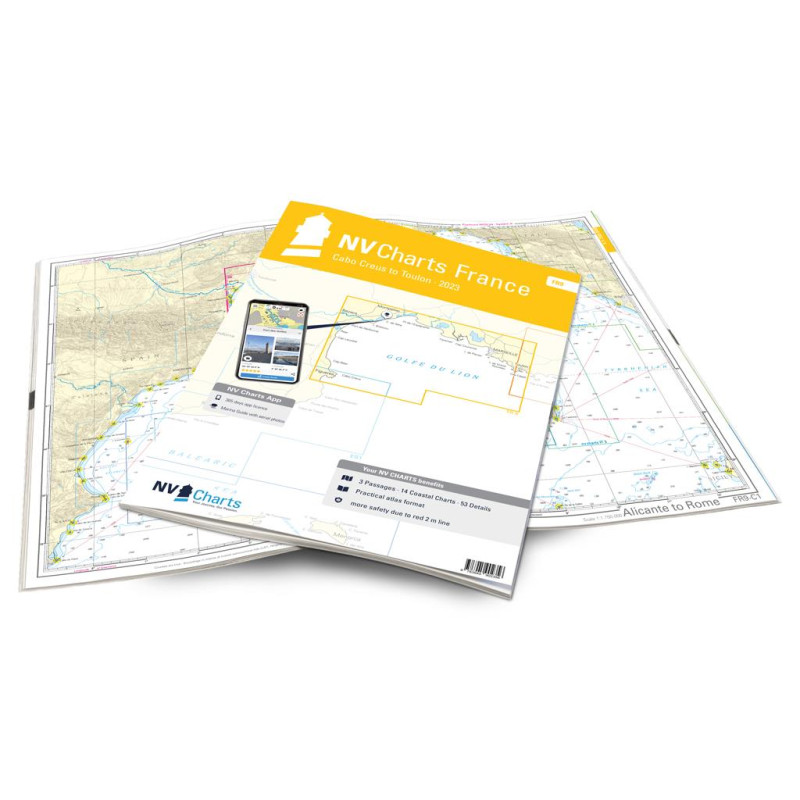
NV Atlas France - FR 9 - Cabo Creus to Toulon
Description
The FR9 accompanies you reliably from the northern Mediterranean coast of Spain - from the wonderful Cap de Creus - to France via the historic port city of Marseille to Toulon. The remarkable Cap de Creus, a peninsula made of bizarre rock formations of the Pyrenees foothills, protrudes approx. 10 km into the sea and attracts with countless bays. Before heading to the French coast, you can moor at the Port de la Selva. On the French side, the port town of Sète, which is about 30 km southwest of Montpellier, is called Little Venice. In general, there are a large number of ports such as Port Camargue, Port-St-Louis-du-Rhône, Port de Martigues and Port Carry le Rouet, until you get to the historic Marseille. A berth there in the Vieux Port of Marseille is recommended, as this port already existed in antiquity. A visit to the Frioulen Islands off the coast of Marseilles is also worthwhile. The enchanting Cassis, which invites you to rest with the Calanque de Port Miou, a viewpoint above the small harbor, is worth a stopover.
Thanks to the clear structure, the skipper can quickly find approaches, harbours and anchorages and is informed of important navigational details that also appear in the NV Charts app. The chart series impresses with its optimal scales and balanced sheet cuts.
This chart set contains
3 Passage Charts14 Coastal Charts
53 Details Charts
Code for the app
Digital charts & navigation programme
Navigation instructions in English and French
Paper harbour plans & Digital
Meets legal requirements for up-to-date paper charts on board








 Cookies