- Nowości
-
Mapy i publikacje
add remove Mapy papierowe add removePublikacje papierowe add remove
-
Nawigacja
add remove Zegary add removeBarometry add removeTermometry , Higrometry, Barografy add removeAreometry (Densymetry) add remove
-
Sygnalizacja
add remove Lampy Nawigacyjne, Szperacze add removeŻarówki add removeLatarki add removeZnaki dzienne add remove
-
Środki ratunkowe
add remove Kamizelki add removeTratwy add removeKombinezony ratunkowe add removePirotechnika morska add removeKoła, Pławki, Tyczki add removeUprzęże, Linki, Taśmy Bezpieczeństwa add removeReflektory radarowe add removeBosaki, Wiosła add remove
-
Elektronika morska
add remove Radiotelefony add removeOdbiorniki Pogody add removePLB / AIS MOB, OLAS add removeRadiopławy, Transpondery add removeWiatromierze add removeAkcesoria add remove
-
Sprzęt pożarowy
add remove Akcesoria add remove
-
Wyposażenie pokładowe
add remove Drabinki Pilotowe, Ewakuacyjne add remove
- Nowości
-
Mapy i publikacje
add remove Mapy papierowe add removePublikacje papierowe add remove
- Nawigacja add remove
- Sygnalizacja add remove
- Środki ratunkowe add remove
- Elektronika morska add remove
- Sprzęt pożarowy add remove
-
Wyposażenie pokładowe
add remove
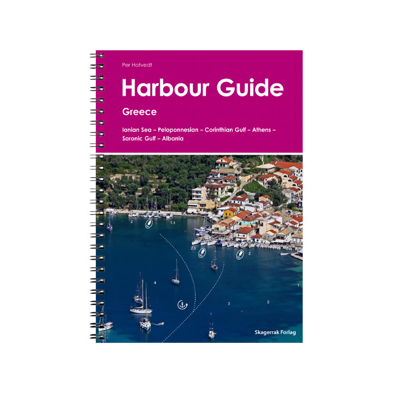
Harbour Guide Greece 1
Description
The Harbour Guide Greece 1 provides a detailed description of all anchorages ports and marinas along the popular and well-developed east coast of Greece including the Gulf of Corinth the Peloponnese Athens and the Saronic Gulf.
The guide also covers the entire coastline of Albania a new and not yet well-developed sailing area.237 ports
bays and natural moorings.
This port guide was written by one of Skagerrak Forlags most experienced skippers Per Hotvedt.
Per has sailed many of the worlds waters. Sailing and exploring the waters of Eastern Greece and Albania.
Collected information and maps and compiled them in this guide.
This port guide like all the guides in our series presents each port on its own page a format developed by Skagerrak Forlag based on the very extensive sailing experience of all the writers and editors who contribute to the production of our guides including the use of our guides at sea. We believe that this format gives skippers and crews the best and easiest access to the information they need to bring their boat safely to port.
Each page features a large aerial photo of the harbour with all the important navigation information including the approach line a clear and large-scale map of the harbour itself text describing the area around the harbour where to eat and what to do and see a description of the mooring and anchorage and an info box.
Supplementary to this harbour guide we recommend for Greece the nautical chart sets NV.Atlas GR 1 Greece - Ionian Islands & Peloponnese - Albania and NV.Atlas GR 2 Greece - Cyclades to Crete & Athens by NV Charts.














 Cookies