- Nowości
-
Mapy i publikacje
add remove Mapy papierowe add removePublikacje papierowe add remove
-
Nawigacja
add remove Zegary add removeBarometry add removeTermometry , Higrometry, Barografy add removeAreometry (Densymetry) add remove
-
Sygnalizacja
add remove Lampy Nawigacyjne, Szperacze add removeŻarówki add removeLatarki add removeZnaki dzienne add remove
-
Środki ratunkowe
add remove Kamizelki add removeTratwy add removeKombinezony ratunkowe add removePirotechnika morska add removeKoła, Pławki, Tyczki add removeUprzęże, Linki, Taśmy Bezpieczeństwa add removeReflektory radarowe add removeBosaki, Wiosła add remove
-
Elektronika morska
add remove Radiotelefony add removeOdbiorniki Pogody add removePLB / AIS MOB, OLAS add removeRadiopławy, Transpondery add removeWiatromierze add removeAkcesoria add remove
-
Sprzęt pożarowy
add remove Akcesoria add remove
-
Wyposażenie pokładowe
add remove Drabinki Pilotowe, Ewakuacyjne add remove
- Nowości
-
Mapy i publikacje
add remove Mapy papierowe add removePublikacje papierowe add remove
- Nawigacja add remove
- Sygnalizacja add remove
- Środki ratunkowe add remove
- Elektronika morska add remove
- Sprzęt pożarowy add remove
-
Wyposażenie pokładowe
add remove
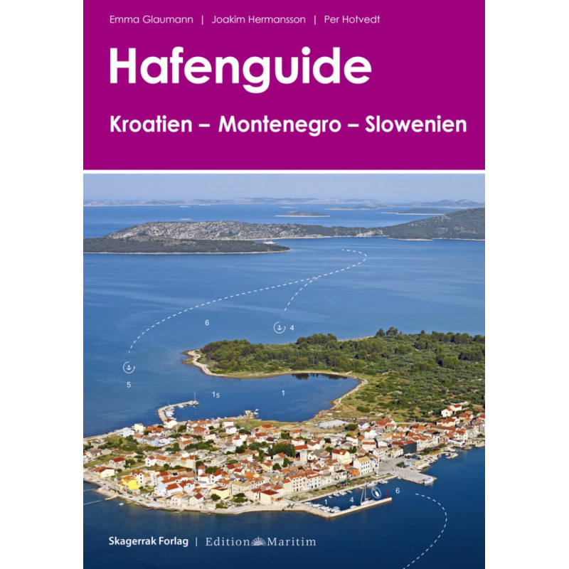
Hafenguide Kroatien - Slowenien - Montenegro
Description
The harbour guide Croatia - Montenegro - Slovenia by Emma Glaumann Joakim Hermansson and Per Hotvedt is described here in a clear and practical way.
Croatia - with its more than 1500 kilometres of coastline and over 1200 islands this dream region on the Adriatic attracts numerous tourists every year who want to explore the charming and varied country on motorboats and sailing yachts. The region has a dense network of modern marinas but lovers of town harbours and small fishing ports will also get their moneys worth.The harbour guide includes not only the harbours of the Croatian regions of Istria Central Dalmatia and Southern Dalmatia but also information on the neighbouring regions of Slovenia and Montenegro.
What can I expect?
Each port is presented on one page with an aerial photograph a detailed port plan and a compact description of how to get there - so getting there is childs play. Short information on history and culture as well as tips on local sights and leisure activities help with travel planning and ensure an all-round successful holiday!
The cruising guide for Slovenia Croatia and Montenegro helps with optimal preparation on a charter yacht or on your own keel. We also recommend the chart sets NV Atlas Croatia HR 1 and NV Atlas Croatia HR 2
The contents at a glance:
Air photos with approach lines and water depthsColoured harbour plans with berths
Utilities and telephone numbers
With practical ring binding









 Cookies