- Nowości
-
Mapy i publikacje
add remove Mapy papierowe add removePublikacje papierowe add remove
-
Nawigacja
add remove Zegary add removeBarometry add removeTermometry , Higrometry, Barografy add removeAreometry (Densymetry) add remove
-
Sygnalizacja
add remove Lampy Nawigacyjne, Szperacze add removeŻarówki add removeLatarki add removeZnaki dzienne add remove
-
Środki ratunkowe
add remove Kamizelki add removeTratwy add removeKombinezony ratunkowe add removePirotechnika morska add removeKoła, Pławki, Tyczki add removeUprzęże, Linki, Taśmy Bezpieczeństwa add removeReflektory radarowe add removeBosaki, Wiosła add remove
-
Elektronika morska
add remove Radiotelefony add removeOdbiorniki Pogody add removePLB / AIS MOB, OLAS add removeRadiopławy, Transpondery add removeWiatromierze add removeAkcesoria add remove
-
Sprzęt pożarowy
add remove Akcesoria add remove
-
Wyposażenie pokładowe
add remove Drabinki Pilotowe, Ewakuacyjne add remove
- Nowości
-
Mapy i publikacje
add remove Mapy papierowe add removePublikacje papierowe add remove
- Nawigacja add remove
- Sygnalizacja add remove
- Środki ratunkowe add remove
- Elektronika morska add remove
- Sprzęt pożarowy add remove
-
Wyposażenie pokładowe
add remove
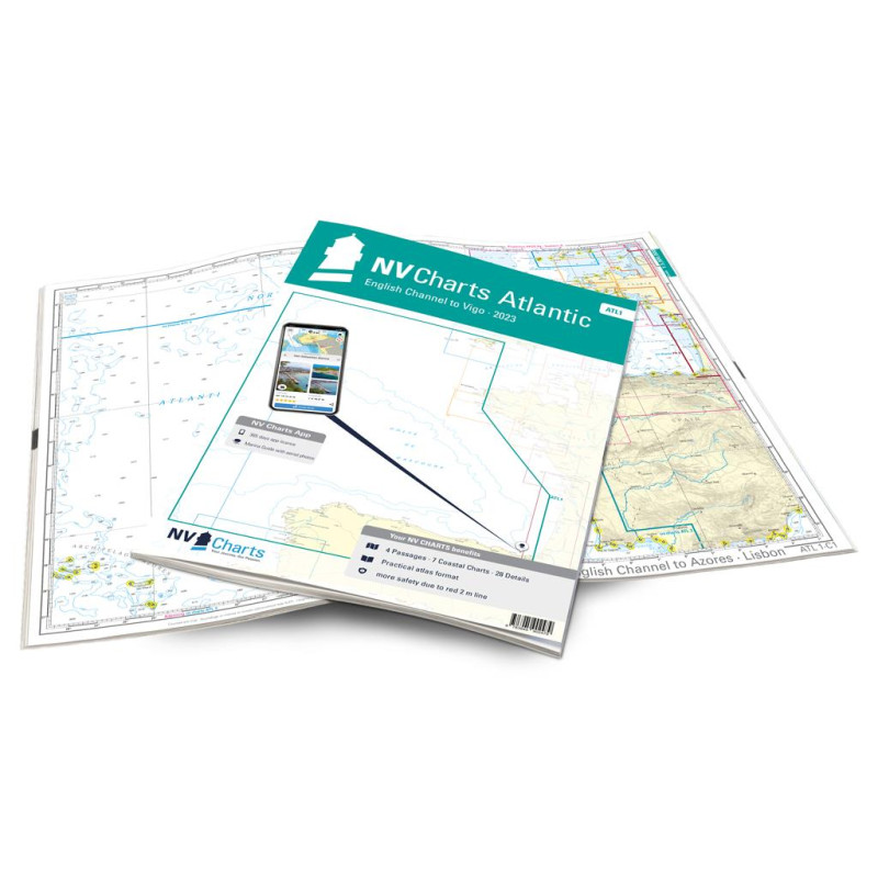
NV Atlas Atlantic - ATL 1 - Falmouth to Vigo - North Coast of Spain
Description
The ATL 1 chart set is suitable for water sports enthusiasts who want to cross the Bay of Biscay and especially want to explore the north coast of Spain. The charts will accompany you to the north of the Spanish west coast, more precisely to the city of Vigo. Please keep in mind that the average water depth is almost 1800m and that, due to currents and turbulences, you need moderate weather for a safe crossing. Coming from the French coast, there are of course various harbours on the Spanish coast that we cover with harbour plans. Cities like San Sebastian, Bilbao, La Coruna and Vigo are definitely worth a trip if you plan enough time. But also nature lovers will get pleased thanks to the mountain ranges, cliffs and lonely bays of northern Spain.
Thanks to the clear structure the skipper can quickly find approaches, harbours and anchorages and is informed of important navigational details that also appear in the NV Charts app. The chart series impresses with its optimal scales and balanced sheet cuts.
This chart set includes
4 Passage Charts7 Coastal Charts
38 Details Charts
Code for the app
Digital charts & navigation programme
Navigation instructions in English
Tide tables
Paper harbour plans & Digital
Meets legal requirements for up-to-date paper charts on board









 Cookies