Zamknij arrow_back
- Nowości
-
Mapy i publikacje
add remove Mapy papierowe add removePublikacje papierowe add remove
-
Nawigacja
add remove Zegary add removeBarometry add removeTermometry , Higrometry, Barografy add removeAreometry (Densymetry) add remove
-
Sygnalizacja
add remove Lampy Nawigacyjne, Szperacze add removeŻarówki add removeLatarki add removeZnaki dzienne add remove
-
Środki ratunkowe
add remove Kamizelki add removeTratwy add removeKombinezony ratunkowe add removePirotechnika morska add removeKoła, Pławki, Tyczki add removeUprzęże, Linki, Taśmy Bezpieczeństwa add removeReflektory radarowe add removeBosaki, Wiosła add remove
-
Elektronika morska
add remove Radiotelefony add removeOdbiorniki Pogody add removePLB / AIS MOB, OLAS add removeRadiopławy, Transpondery add removeWiatromierze add removeAkcesoria add remove
-
Sprzęt pożarowy
add remove Akcesoria add remove
-
Wyposażenie pokładowe
add remove Drabinki Pilotowe, Ewakuacyjne add remove
- Nowości
-
Mapy i publikacje
add remove Mapy papierowe add removePublikacje papierowe add remove
- Nawigacja add remove
- Sygnalizacja add remove
- Środki ratunkowe add remove
- Elektronika morska add remove
- Sprzęt pożarowy add remove
-
Wyposażenie pokładowe
add remove
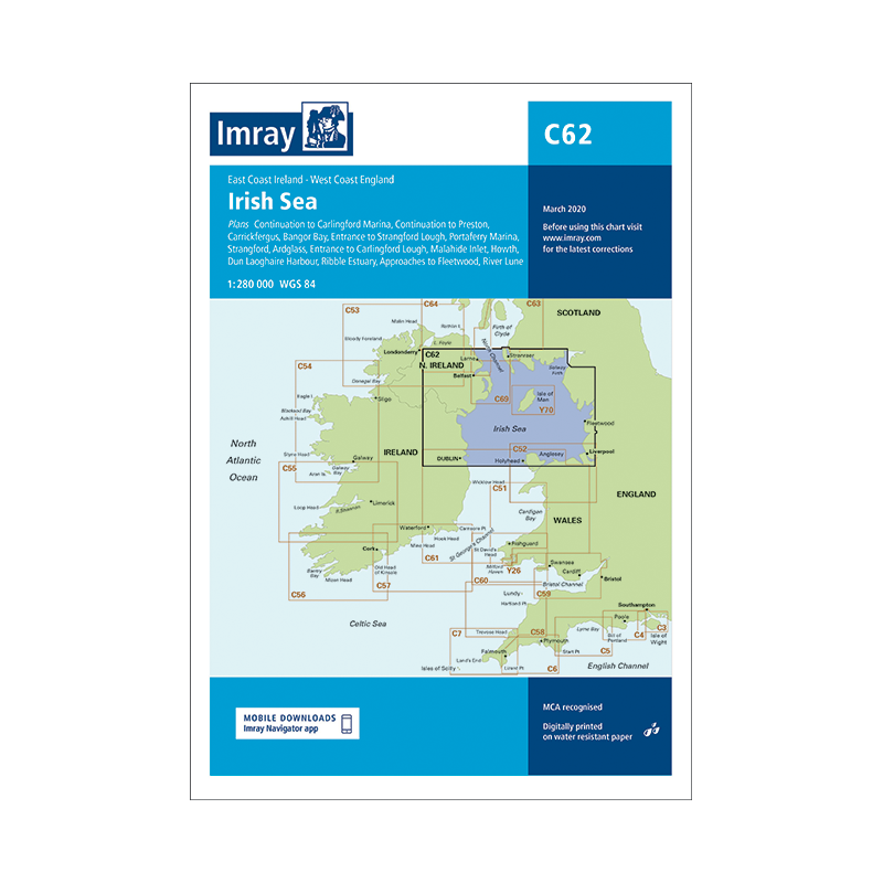
C62 Irish Sea
C62 Morze Irlandzkie
C62 to mapa morska obejmująca Morze Irlandzkie od Milford Haven do Portpatrick i od Rathlin Island do Carnsore Point
Skala: 1: 280 000
Zawiera plany:
Carrickfergus (1:15 000)
Bangor Bay (1:17 500)
Entrance to Strangford Lough (1:37 500)
Portaferry Marina (1:7500)
Strangford (1:5000)
Ardglass (1:15 000)
Entrance to Carlingford Lough (1:26 000)
Malahide Inlet (1:35 000)
Howth (1:12 500)
Dun Laoghaire Harbour (1:15 000)
Ribble Estuary (1:125 000)
Approaches to Fleetwood (1:50 000)
River Lune (1:100 000)
Continuation to Carlingford Marina (1:40 000)
Continuation to Preston (1:125 000)
On this edition the chart specification has been improved to show coloured light flashes. Updated bathymetric data has been included where available. The firing practice areas have been updated. There has been general updating throughout.
Podobne z kategorii
Availability: Out of stock















 Cookies