Zamknij arrow_back
- Nowości
-
Mapy i publikacje
add remove Mapy papierowe add removePublikacje papierowe add remove
-
Nawigacja
add remove Zegary add removeBarometry add removeTermometry , Higrometry, Barografy add removeAreometry (Densymetry) add remove
-
Sygnalizacja
add remove Lampy Nawigacyjne, Szperacze add removeŻarówki add removeLatarki add removeZnaki dzienne add remove
-
Środki ratunkowe
add remove Kamizelki add removeTratwy add removeKombinezony ratunkowe add removePirotechnika morska add removeKoła, Pławki, Tyczki add removeUprzęże, Linki, Taśmy Bezpieczeństwa add removeReflektory radarowe add removeBosaki, Wiosła add remove
-
Elektronika morska
add remove Radiotelefony add removeOdbiorniki Pogody add removePLB / AIS MOB, OLAS add removeRadiopławy, Transpondery add removeWiatromierze add removeAkcesoria add remove
-
Sprzęt pożarowy
add remove Akcesoria add remove
-
Wyposażenie pokładowe
add remove Drabinki Pilotowe, Ewakuacyjne add remove
- Nowości
-
Mapy i publikacje
add remove Mapy papierowe add removePublikacje papierowe add remove
- Nawigacja add remove
- Sygnalizacja add remove
- Środki ratunkowe add remove
- Elektronika morska add remove
- Sprzęt pożarowy add remove
-
Wyposażenie pokładowe
add remove
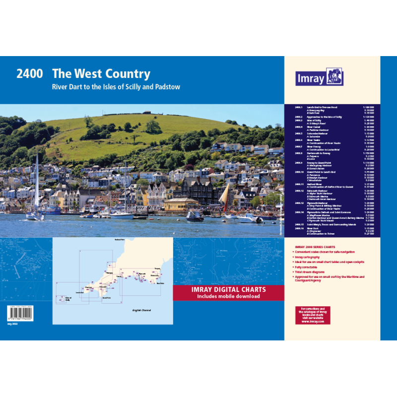
2400 West Country Chart Atlas
Mapa imray 2400 West Country Chart Pack jest zbiorem 25 map żeglarskich obejmujących południowo-zachodnie wybrzeże Anglii od Bridport do Padstow. Mapy są wykonane z wodoodpornego papieru i zawierają najnowsze informacje nawigacyjne i hydrograficzne. Mapy są zgodne ze standardami Admiralicji i są aktualizowane co roku. Mapa imray 2400 West Country Chart Pack jest niezbędnym narzędziem dla żeglarzy planujących podróż po tym malowniczym regionie.
Zawiera plany:
2400.1 Land’s End to Trevose Head
1: 180 000 WGS 84
Includes plans Newquay Bay (1:10 000) and Saint Ives (1:15 000)
2400.2 Approaches to the Isles of Scilly
1: 120 000 WGS 84
2400.3 Isles of Scilly
1: 40 000 WGS 84
Includes plan St Mary’s Road (1:25 000)
2400.4 River Camel
1: 30 000 WGS 84
Includes plan Padstow Harbour (1:10 000)
2400.5 Salcombe Harbour
1: 15 000 WGS 84
Includes plan Salcombe (1:9000)
2400.6 River Yealm
1: 12 500 WGS 84
Includes plan Continuation of River Yealm (1:15 000)
2400.7 River Fowey
1: 9000 WGS 84
Includes plan Continuation to Lostwithiel (1:20 000)
2400.8 Dartmouth to Fowey
1: 150 000 WGS 84
Includes plans Polperro (1:3500) and Looe (1:10 000)
2400.9 Fowey to Lizard Point
1: 110 000 WGS 84
Includes plans Mevagissey Harbour (1:3500) and Gorran Haven (1:30 000)
2400.10 Lizard Point to Land’s End
1: 75 000 WGS 84
Includes plans Penzance (1:12 000), Newlyn Harbour (1:10 000) and Mousehole (1:5000)
2400.11 Helford River
1: 17 000 WGS 84
Includes plan Continuation of Helford River to Gweek (1:17 000)
2400.12 Falmouth Harbour
1: 20 000 WGS 84
Includes plans Mylor Yacht Harbour (1:10 000), Falmouth Marina (1:5000) and Falmouth Inner Harbour (1:10 000)
2400.13 Plymouth Harbour
1: 20 000 WGS 84
Includes plans King Point & Millbay Marinas (1:10 000) and Continuation of River Yealm (1:20 000)
2400.14 Plymouth to Saltash and Saint Germans
1: 20 000 WGS 84
Includes plans Mayflower Marina (1:5000), Sutton Harbour and Queen Anne’s Battery Marina (1:7500) and Plymouth Yacht Haven (1:5000)
2400.15 Saint Mary’s, Tresco and Surrounding Islands
1: 20 000 WGS 84
2400.16 River Dart
1: 15 000 WGS 84
Plans Kingswear, Continuation to Totnes
Podobne z kategorii
Availability: Out of stock
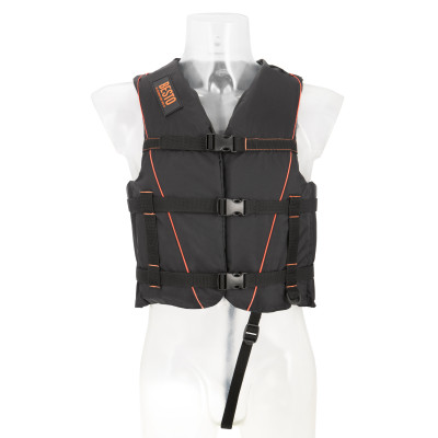
Kamizelka SKI 50N • Kolor: Czarny/Pomarańczowy • Wyporność: 40N • Waga: 50-60 kg • Rozmiar: M













 Cookies