Zamknij arrow_back
- Nowości
-
Mapy i publikacje
add remove Mapy papierowe add removePublikacje papierowe add remove
-
Nawigacja
add remove Zegary add removeBarometry add removeTermometry , Higrometry, Barografy add removeAreometry (Densymetry) add remove
-
Sygnalizacja
add remove Lampy Nawigacyjne, Szperacze add removeŻarówki add removeLatarki add removeZnaki dzienne add remove
-
Środki ratunkowe
add remove Kamizelki add removeTratwy add removeKombinezony ratunkowe add removePirotechnika morska add removeKoła, Pławki, Tyczki add removeUprzęże, Linki, Taśmy Bezpieczeństwa add removeReflektory radarowe add removeBosaki, Wiosła add remove
-
Elektronika morska
add remove Radiotelefony add removeOdbiorniki Pogody add removePLB / AIS MOB, OLAS add removeRadiopławy, Transpondery add removeWiatromierze add removeAkcesoria add remove
-
Sprzęt pożarowy
add remove Akcesoria add remove
-
Wyposażenie pokładowe
add remove Drabinki Pilotowe, Ewakuacyjne add remove
- Nowości
-
Mapy i publikacje
add remove Mapy papierowe add removePublikacje papierowe add remove
- Nawigacja add remove
- Sygnalizacja add remove
- Środki ratunkowe add remove
- Elektronika morska add remove
- Sprzęt pożarowy add remove
-
Wyposażenie pokładowe
add remove
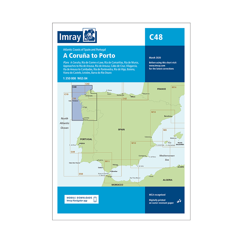
C48 A Coruña to Porto
Edycja 2020
C48 Z Coruña do Porto
Mapa C48 Imray to szczegółowa mapa morska Morza Adriatyckiego. Obejmuje wybrzeża Chorwacji, Albanii, Czarnogóry, Grecji i Włoch. Zawiera wiele szczegółów, w tym głębokości, przeszkody, nawigacyjne światła i latarnie. Jest to przydatne narzędzie dla żeglarzy i innych użytkowników morza.
Skala: 1: 350 000
Zawiera plany:
A Coruña (1:50 000)
Ría de Corme e Laxe (1:75 000)
Ría de Camariñas (1:50 000)
Ría de Muros (1:75 000)
Approaches to Ría de Arousa (1:150 000)
Ría de Arousa (1:150 000)
Cabo de Cruz (1:40 000)
Vilagarcía (1:35 000)
Illa de Arousa to Cambados (1:40 000)
Ría de Pontevedra (1:150 000)
Ría de Vigo (1:150 000)
Baiona (1:85 000)
Viana do Castelo (1:30 000)
Leixões (1:20 000)
Barra do Rio Douro (1:20 000))
On this edition the chart specification has been improved to show coloured light flashes. There have been numerous updates to harbour developments across the chart. The plan of Ría de Camariñas has been extended westward to include a larger scale approach and full charting of Las Quebrantas bank. There has been general updating throughout.
Podobne z kategorii
Availability: 1 In Stock
Edycja: 2023
Availability: Out of stock
Edycja: 2023









 Cookies