- menu title
-
Custom Menu
add remove
-
Navigation
add remove
-
menu title
add remove
-
menu title
add remove
-
menu title
add remove
-
menu title
add remove
-
menu title
add remove
- menu title
-
Custom Menu
add remove
- Navigation add remove
-
menu title
add remove
-
menu title
add remove
-
menu title
add remove
-
menu title
add remove
-
menu title
add remove
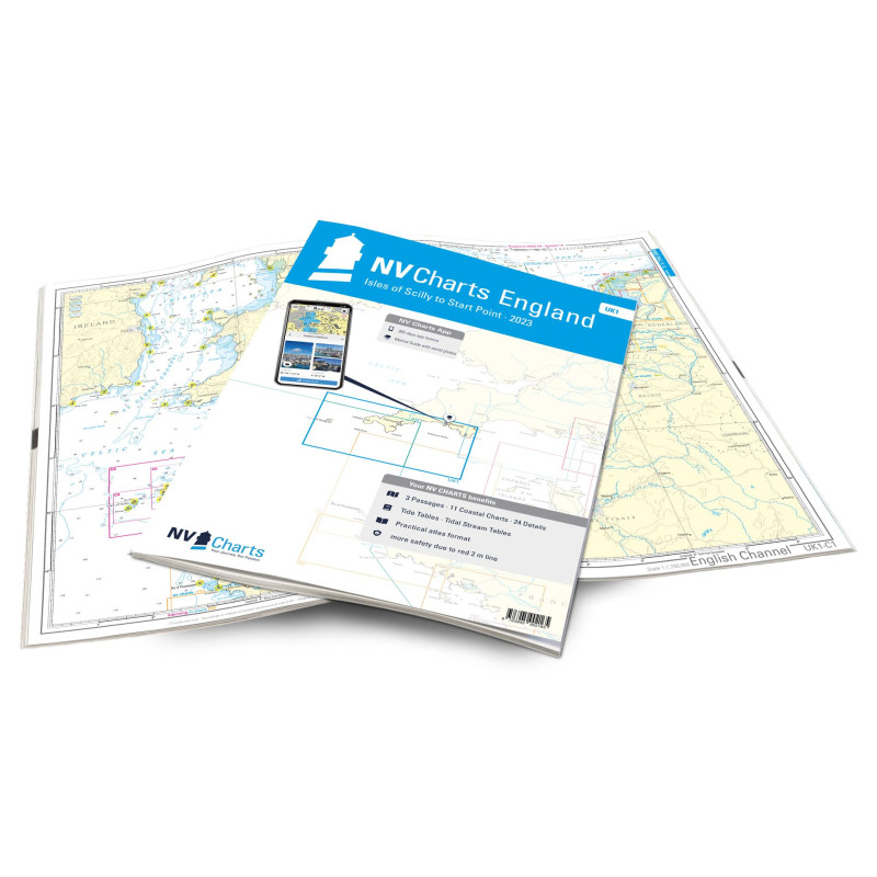
NV. England UK 1 - Isles of Scilly to Start Point - atlas map
Description
After circumnavigating Start Point, the UK1 takes you straight to historic Plymouth, where the River Tamar forms the border between Devon and Cornwall. The Atlantic is close and that becomes clear on the romantic Cornish coast. Falmouth and Helford, delightful harbour towns, are ideal starting points. Protected by the Cornish coast, Lizard Point leads to Mounts Bay. Places like Mousehole are worth a visit on their own. The Isles of Scilly can be reached from the charming Land's End. In a subtropical climate, the 140 islands in the middle of the Atlantic are easy to explore. If the winds are too strong, it is better to stay close to the coast and enjoy the west coast of Cornwall to Cape Cornwall.
Our charts are based on official data from the United Kingdom Hydrographic Office (UKHO) and contain additional harbour plans and details for approaches and passages in the waters. Thanks to the clear structure, the skipper can quickly find tide data, approaches, harbours and anchorages and is informed of important navigational details that also appear in the NV Charts app. The chart series impresses with its optimal scales and balanced sheet cuts.
This chart set includes
3 Passage Charts11 Coastal Charts
24 Details charts
Code for the app
Digital charts & navigation program
Navigation instructions in English
Tide tables
Paper harbour charts & Digital
Meets legal requirements for up-to-date paper charts on board













 Cookies