- menu title
-
Custom Menu
add remove
-
Navigation
add remove
-
menu title
add remove
-
menu title
add remove
-
menu title
add remove
-
menu title
add remove
-
menu title
add remove
- menu title
-
Custom Menu
add remove
- Navigation add remove
-
menu title
add remove
-
menu title
add remove
-
menu title
add remove
-
menu title
add remove
-
menu title
add remove
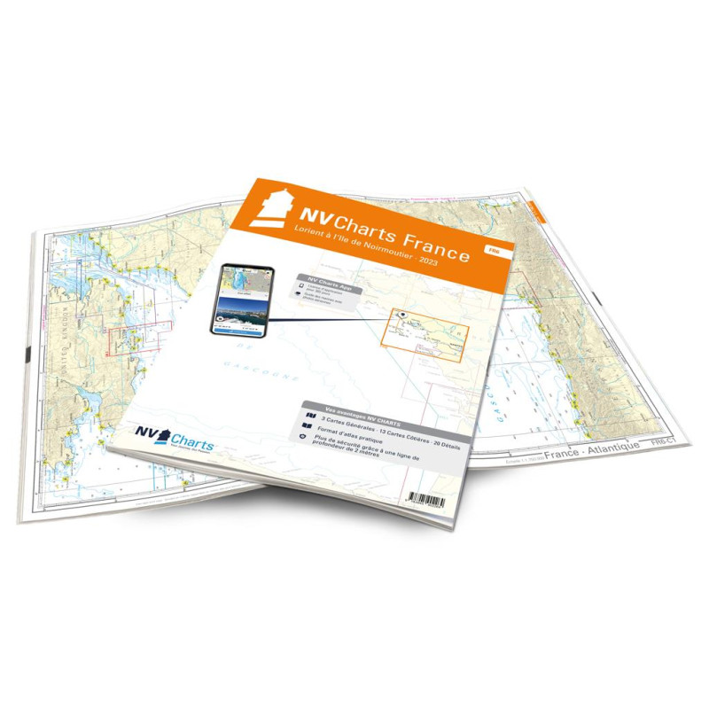
NV Atlas France - FR 6 - Lorient à Île de Noirmoutier - Nantes
Description
You can either start with the FR6 in Lorient, the city of sailing, or travel there from the south. Because the Cité de la Voile should definitely be visited, if only to visit the interactive sailing museum. This city is still home to about 90 international sports sailing teams.
When you've had enough of the sailing hype, this set of charts will take you directly to the largest island in Brittany, the Belle-Ile, south of Lorient. There is a port in Le Palais, which consists of three basins. The region around the Gulf of Morhiban, an inland water area, is highly recommended. But be careful: When the tide is out, it's actually low tide there. If you are already in this region, a visit to the episcopal city of Vannes is also worthwhile. The Île de Noirmoutier as an important venue for various sailing regattas is also worth a detour.
Thanks to the clear structure, the skipper can quickly find approaches, harbours and anchorages and is informed of important navigational details that also appear in the NV Charts app. The chart series impresses with its optimal scales and balanced sheet cuts.
This chart set includes
3 Passage Charts13 Coastal Charts
20 Details Charts
Code for the app
Digital charts & navigation programme
Navigation notes in English and French
Tide tables
Paper harbour plans & Digital
Meets legal requirements for up-to-date paper charts on board













 Cookies