- menu title
-
Custom Menu
add remove
-
Navigation
add remove
-
menu title
add remove
-
menu title
add remove
-
menu title
add remove
-
menu title
add remove
-
menu title
add remove
- menu title
-
Custom Menu
add remove
- Navigation add remove
-
menu title
add remove
-
menu title
add remove
-
menu title
add remove
-
menu title
add remove
-
menu title
add remove
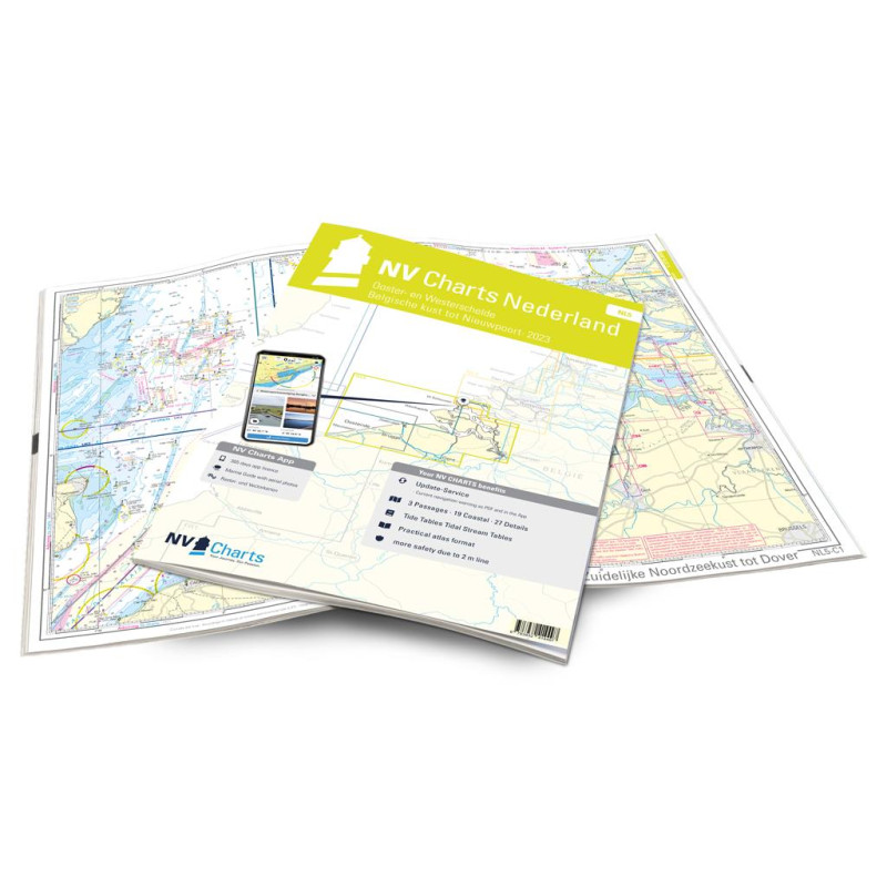
NV Atlas Nederland - NL 5 - Ooster- en Westerschelde
Description
If you want to travel through the "Oosterschelde" and "Westerschelde" delta regions, you will find a suitable travel companion in NL5. This varied beautiful region is characterized by tides and nature reserves. Therefore, you should deal with the topic of tides and currents before starting your trip and when planning the trip, note that entry into some nature reserves is only permitted to a limited extent or even completely prohibited. If you want to drive into the cities of Ghent and Antwerp, this atlas is very well advised. However, especially when entering Antwerp, you should also pay attention to freight traffic. The relatively short coast of Belgium is also completely covered in the NL5. Here too, the strong currents should not be underestimated. The three largest ports Nieuwpoort, Zeebrugge and Oostende are located directly on the coast. Worth a visit is Nieuwpoort, Belgium's sailing center.
Thanks to the clear structure of the nautical chart, the skipper can quickly find approaches, harbours and anchorages and is informed of important navigational details that also appear in the NV Charts app. The tide data and current information are also available in the app. The chart series impresses with its detailed scales and optimal sheet cuts.
This chart set contains
3 oversailers16 precinct charts
26 detailed charts
Code for App
Digital charts & Navigation program 365 days licence
Current data in the digital charts
Tidal calendar
Paper harbour plans & Digital










 Cookies